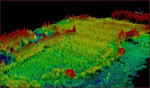
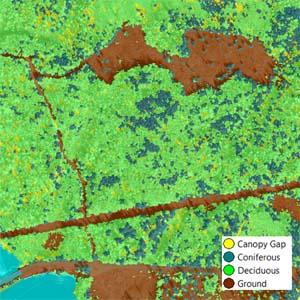
This is a crucial time to better understand our dynamic forest resources by creating improved information for sustainable management. Though developing forest canopy information from stereo imagery has been demonstrated for decades, until recently frequent mapping and monitoring in three dimensions (3D) at a statewide scale has been computationally infeasible. This research extends our ongoing work mapping forest change at high temporal frequency using stereo satellite imagery by providing estimates of volume, biomass, and other important characteristics of the forest important for forest inventory. These estimates will be driven and trained by a dense network of field reference data and reliable algorithms to estimate forest metrics in three dimensions and over time (4D).
We are developing novel computational methods to extract the aforementioned inventory parameters from surface models constructed from high spatial and temporal resolution satellite imagery. Data products will be customized to meet the broadest range of needs possible for the public and private sector. By more frequently monitoring changes in our forest canopy with satellite and aerial remote sensing techniques, land managers will be capable of addressing a myriad of forest resource management challenge and operational needs.


