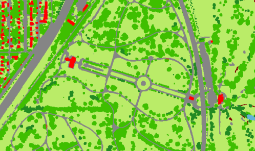
Trees are an important component of urban environments. In addition to their aesthetic value, trees have significant economic and environmental benefits, including: reducing stormwater runoff, energy conservation, improving air quality, and enhancement of community vitality, stability and property values for residential and business areas. An urban tree canopy (UTC) assessment that estimates the amount of tree canopy currently present, along with the amount of tree canopy that could potentially be established, is the first step in the UTC goal-setting process. Accurate maps and information on the amount of tree and forest cover is not routinely available, and would be expensive to acquire by field mapping methods. Analysis and classification of remote sensing imagery, along with geographic information system (GIS) analysis and modeling, provide the most efficient method for assessment.
The RSGAL has classified and mapped the land and tree cover multiple times over different extents (these data can be viewed and/or downloaded by visiting the links under the "Data" menu on this site):
- 2009, the cities of Minneapolis, Saint Paul, and Woodbury using Quickbird satellite imagery and lidar point cloud data
- 2013-14, the state of Minnesota using Landsat imagery and lidar
- 2010, statewide canopy height model (CHM) using lidar
- 2015, the Twin Cities, Duluth, and Rochester using 1-meter NAIP imagery and lidar.
